Explore the Legacy of South Dakota’s Nine Native Nations
Tap on a tribe to learn more about its history and explore how members have made a lasting impact on business, politics, the arts, education, sports, and more. These men and women have shaped history and continue to inspire future generations.

Cheyenne River
The Cheyenne River Reservation spans 1.4 million acres across Dewey and Ziebach Counties in South Dakota. Home to the Cheyenne River Sioux Tribe, the tribe is part of the Teton Division of the Lakota and consists of four bands: Minnecoujou (Planters by the River), Two Kettle (Oohenunpa), Sans Arc (Itazipco), and Blackfoot (Si Sapa). The tribal headquarters is in Eagle Butte, SD, and the traditional language spoken is Lakota. The total population is 8,594, with an estimated tribal enrollment of 15,993.
The present land base of the Cheyenne River Indian Reservation was established through the 1851 and 1868 Fort Laramie Treaties and the Sioux Act of 1889. Before these agreements, the Lakota bands placed within the reservation had no set boundaries, as they were nomadic hunters who traveled in pursuit of their primary food source, the sacred American bison (buffalo).
Cheyenne River Inductees
Tap the photos below to learn more about each Inductee.


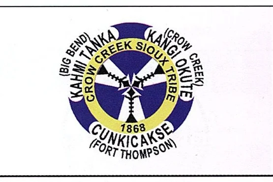
Crow Creek Sioux Tribe
The Crow Creek Reservation spans 125,000 acres across Buffalo, Hyde, and Hughes Counties in South Dakota. Home to the Crow Creek Sioux Tribe, the reservation is comprised of the Mdewakanton (People of Spirit Lake) and Ihanktonwan (People of the End) bands, belonging to the Santee and Yankton Divisions. The tribal headquarters is in Fort Thompson, where Dakota is the traditional language spoken. With an estimated tribal enrollment of 4,600 and a total population of 2,176, the reservation is flanked by the Missouri River, with its western and southern boundaries including Lake Sharpe and Lake Francis Case—reservoirs created by the Big Bend and Fort Randall Dams. Covering approximately 400 square miles, it is the third smallest of South Dakota’s nine reservations, with about 35 square miles of water.
Crow Creek inductees
Tap the photos below to learn more about each Inductee.


Flandreau Santee Sioux Tribe
The Flandreau Santee Sioux Reservation is in southeastern South Dakota, bordering Minnesota in Moody County. Covering nearly 2,500 acres along the Big Sioux River, the land is part of the Prairie Coteau, characterized by rolling terrain. The Flandreau Santee Sioux Tribe descends primarily from the Mdewakantonwan and Wahpekute bands of the Isantidivision of the Great Sioux Nation. Historically, river-plains people, they engaged in farming and buffalo hunting. Originally residing in Minnesota and Wisconsin, the Santee were forced onto reservations in 1851 due to pressure from settlers. Following the Dakota Uprising of 1862, which was crushed by the U.S. government, many Santee were imprisoned or relocated to camps in Iowa and South Dakota. In 1869, Christianized families from these groups settled along the Big Sioux River, establishing homesteads and founding the First Presbyterian Church in 1873, the oldest continuously used church in South Dakota. The town of Flandreau, named after U.S. Indian Agent Charles E. Flandrau, was initially settled in 1857 but abandoned due to conflicts with the Yankton Sioux. It was resettled in 1872 and became the Moody County seat in 1873. Sioux Falls politician Richard F. Pettigrew established the Briggs Institute in 1892, now known as Flandreau Indian School. In 1934, under the Indian Reorganization Act, the Flandreau Santee Sioux Tribe was formally recognized as a self-governing entity. Today, the tribe has an estimated enrollment of 736 members, with a total population of 444.

Lower Brule Sioux Tribe
The Lower Brule Reservation covers 258,560 acres in Lyman and Stanley Counties, South Dakota. It is part of the Teton Division and consists of the Sicangu (Brule or Burnt Thigh) band. The tribal headquarters is in Lower Brule, SD, and the traditional language spoken is Lakota. With a total population of 1,689 and an estimated tribal enrollment of 3,410, the Lower Brule Sioux Tribe maintains its cultural identity and connection to the land. For thousands of years, the Lower Brule people lived in the grasslands and river valleys between the Rocky Mountains and the Great Lakes, but their world changed drastically with the arrival of U.S. government agents in 1804. A series of treaties, including the 1825 Fort Lookout Treaty and the 1851 and 1868 Fort Laramie Treaties, imposed territorial limits for the first time, culminating in the 1865 Fort Sully Treaty, which established the Lower Brule Reservation. However, subsequent policies such as the 1876 Indian Appropriations Act, the 1877 Manypenny Agreement, and the 1887 Dawes Act further reduced tribal lands. In the 20th century, the construction of Missouri River dams under the Pick-Sloan Act of 1944 led to devastating losses, as the Fort Randall Taking Act (1954) and Big Bend Taking Act (1962) flooded vast portions of the reservation, displacing families and destroying cultural sites. Despite these challenges, the Lower Brule Sioux Tribe remains committed to reclaiming its ancestral lands. Since 1999, federal legislation such as the Water Resources Development Act and the Cobell Settlement Agreement has helped return thousands of acres to tribal trust, and the tribe has actively repurchased lost lands.
Lower Brule Inductees
Tap the photos below to learn more about each Inductee.


Oglala Lakota (Pine Ridge Reservation)
The Pine Ridge Indian Reservation, home to the Oglala Lakota Nation, spans approximately 2.2 million acres across Bennett, Jackson, and Oglala Lakota counties in southwestern South Dakota. Bordered by Nebraska to the south, the Rosebud Reservation to the east, and Badlands National Park to the north, the landscape features rolling grasslands, dryland prairie, and pine-covered hills that give Pine Ridge its name. Tribal headquarters are in the town of Pine Ridge. The Oglala, meaning "Scatter Their Own," are one of the seven bands of the Teton (Lakota) division of the Great Sioux Nation. The reservation’s diverse geography includes picturesque plains, rugged Badlands, and small extensions of the Black Hills, creating a striking and historically rich environment. Estimated tribal enrollment is 46,855, with a total population of 19,950.
Oglala Sioux Inductees
Tap the photos below to learn more about each Inductee.


Rosebud Sioux Tribe
The Rosebud Reservation spans 950,000 acres across Todd, Mellette, and Tripp Counties in South Dakota, with the tribal headquarters in Rosebud. Home to the Sicangu (Brule or Burnt Thigh) band of the Teton Division, the reservation features vast grasslands interspersed with Ponderosa Pine forests, steep hills, ravines, and lakes. The traditional language spoken is Lakota, and an estimated 22,350 enrolled members and 10,000 non-tribal members call the reservation home. The Rosebud reservation is the sixth largest in the U.S.
Rosebud Sioux Inductees
Tap the photos below to learn more about each Inductee.


Sisseton Wahpeton Oyate
The Sisseton Wahpeton Oyate is located on the former Lake Traverse Reservation, covering parts of Marshall, Day, Codington, Grant, and Roberts Counties in South Dakota. The tribe is part of the Santee Division and consists of the Sisseton (People of the March) and Wahpeton (People on Lake Traverse) bands. The tribal headquarters is in Agency Village, SD, and the traditional language spoken is Dakota. The Sisseton Wahpeton Oyate has a total population of 11,095 and an estimated tribal enrollment of 12,389. Nestled amidst the rolling hills of northeastern South Dakota and southeastern North Dakota, the tribe’s lands are characterized by lush prairies shaped by glaciers. The Sisseton Wahpeton Oyate Reservation spans over 111,000 acres.
Sisseton Wahpeton Oyate Inductees
Tap the photos below to learn more about each Inductee.


Standing Rock Sioux
The Standing Rock Sioux Reservation, spanning North and South Dakota, was originally part of the Great Sioux Reservation, which encompassed all land west of the Missouri River, including the Black Hills. The 1868 Fort Laramie Treaty granted the Sioux Nation off-reservation hunting rights and required three-fourths approval for any land cessions. However, in 1877, the U.S. government unilaterally took the Black Hills without consent. The Standing Rock Agency was established at Fort Yates in 1873, and in 1889, Congress further divided the Great Sioux Reservation into six smaller reservations, including Standing Rock. Today, the reservation covers 841,700 acres, with a population of 8,553 and an estimated tribal enrollment of 16,102. The tribal headquarters is in Fort Yates, North Dakota, with the South Dakota side of the reservation falling in the Mountain Time Zone.
Standing Rock Inductees
Tap the photos below to learn more about each Inductee.


Yankton Sioux Tribe
The Yankton Reservation covers approximately 40,000 acres in Charles Mix County, South Dakota, with a total population of 6,824 and an estimated tribal enrollment of 11,594. The tribe belongs to the Yankton Division and is made up of the Ihanktonwan band. The tribal headquarters is in Wagner, SD, and the traditional language spoken is Dakota. Their Dakota name, IhaƞktoƞwaƞDakota Oyate, meaning "People of the End Village," originates from the time when the tribe lived at the end of Spirit Lake, just north of Mille Lacs Lake. Historically, the Yankton Sioux are known as the protectors of the sacred Pipestone Quarry for the OcetiSakowin (Dakota).
Yankton Sioux Inductees
Tap the photos below to learn more about each Inductee.

